Disaster Management UAV
An autonomous drone that finds people when GPS gives up · All India Rank 7, Aerothon 2024
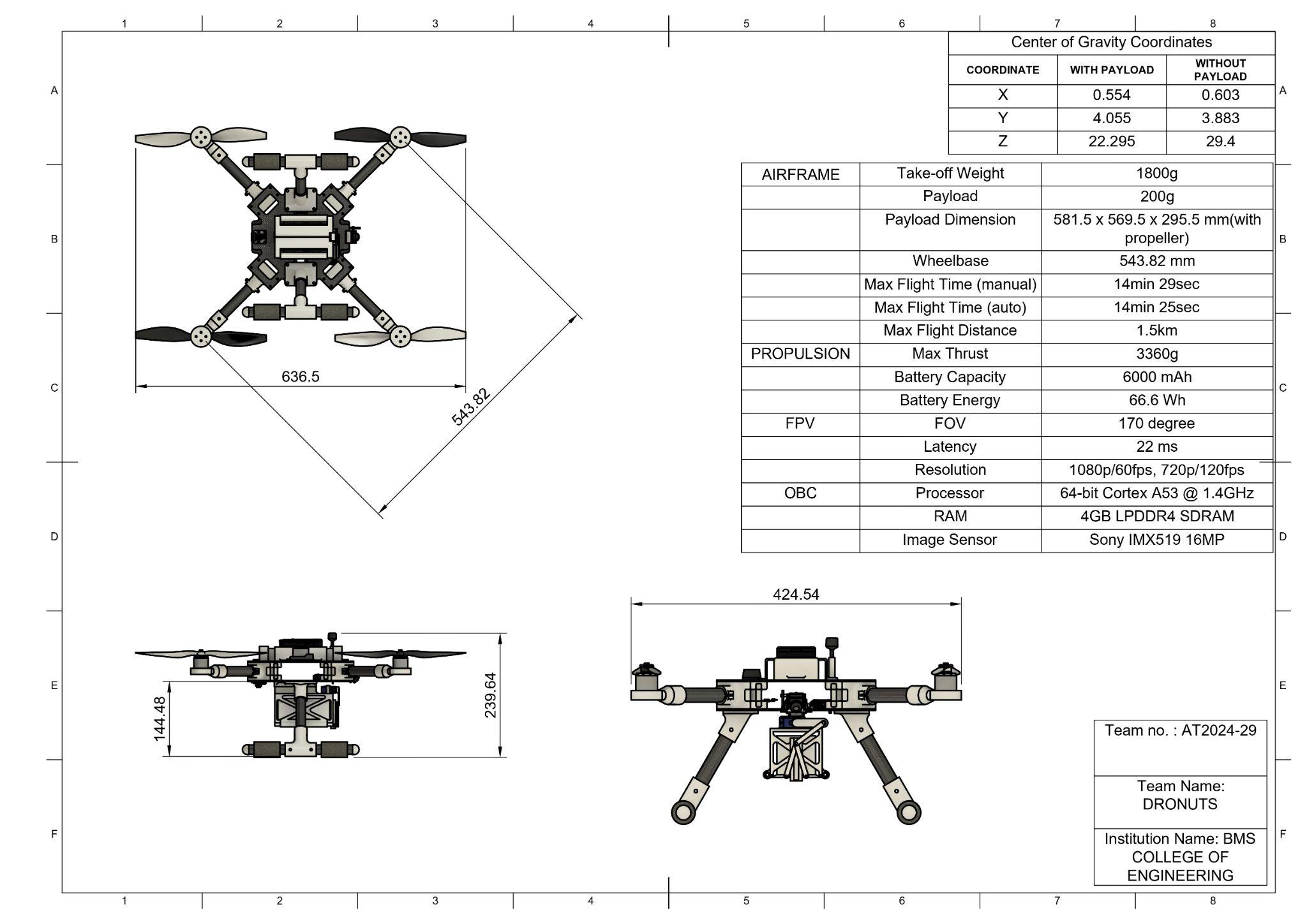
Disasters take the cell towers and the GPS with them. The useful drone is the one that still flies after that. We built a UAV for the case where the sky is not helping: cover the zone, find people, do not trust a lock you just lost. Team name: Dronuts. (yes.)
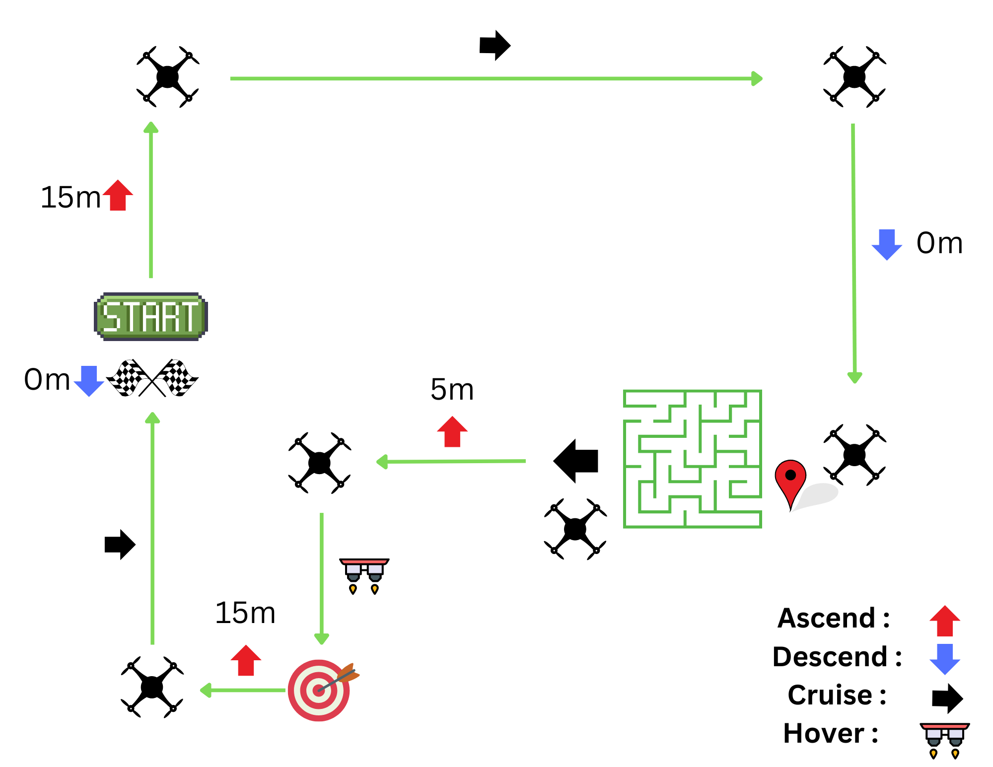
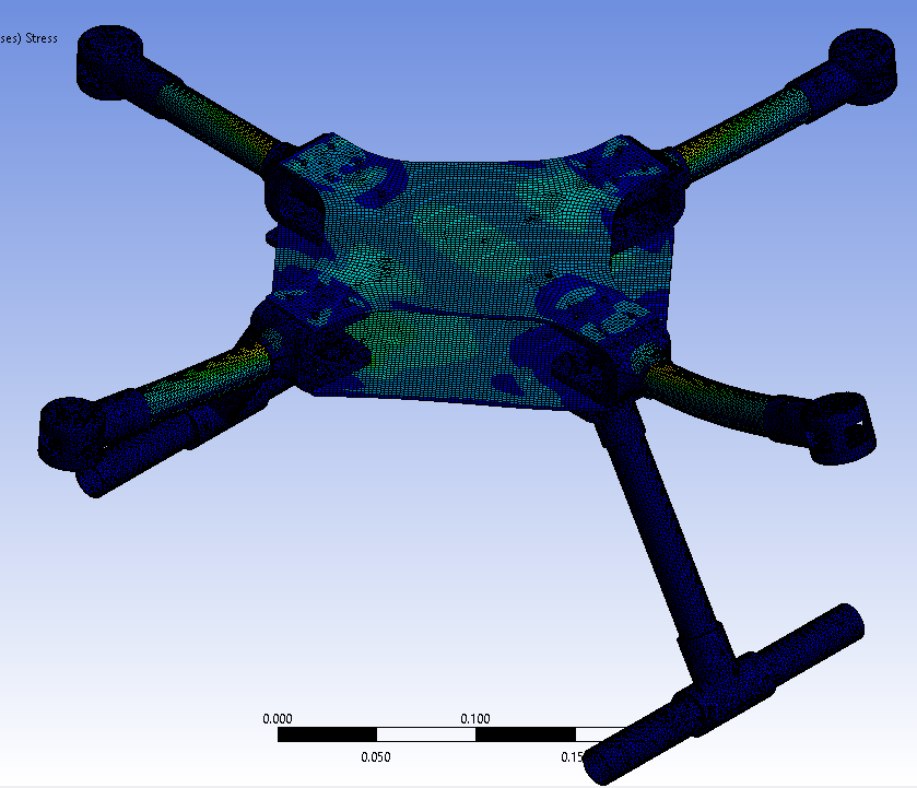
I did onboard YOLOv8 detection and the path-planning work. A pretty route that assumed a GPS fix is a route to the ground. The mission on paper is climb, cruise, a maze, a hover, and home. Hover looks easy until the airframe is the thing you have to get back.
All India Rank 7 of 100 at Aerothon. In an ML class a wrong prediction costs a metric. On a UAV it costs the UAV. You learn to test. Roughly one hard landing in.